Early 2020, a World Bank Group team contacted EO4SD FCS team to provide support in the supervision and evaluation of the Youth Employment and Skills Development Project for Burkina Faso. The project objective is to increase the accessibility of rural villages and encourage access to temporary employment and skills development opportunities for out-of-school youth. This case study was designed to assist the World Bank in assessing the results on the ground of infrastructure investments in support of the WB project's primary objective.
The service demonstration was led by CLS with the support of GISBOX. Thanks to remotely sensed images, the team evaluated the completion of transportation infrastructure (gravel roads mainly), as well as other small infrastructure projects (wells, boulis, defense walls etc.) that will help to reduce isolation and improve conditions of the remote communities. For each selected area, mainly located in the northern region of the country, 2 dates of analysis were chosen to reflect the evolution before and after the WB project implementation (2015/2016 and 2019/2020). The analysis was conducted by means of visual interpretation on very high-resolution optical satellite imagery (pixel size is 0.5m) over 6 Areas of Interest in Burkina Faso. The results are presented in two distinct products: the first one is focused on the detailed assessment of status and condition of specific roads, and the second one concerns the detection of the small infrastructures developed in the same area.

Figure 1: Localization of the Areas of Interest
The analysis was conducted by means of visual interpretation on very high resolution optical satellite imagery (pixel size is 0.5m) over 6 Areas of Interest in Burkina Faso. The results are presented in two distinct products: the first one is focused on the detailed assessment of status and condition of specific roads, and the second one concerns the detection of the small infrastructures developed in the same area.
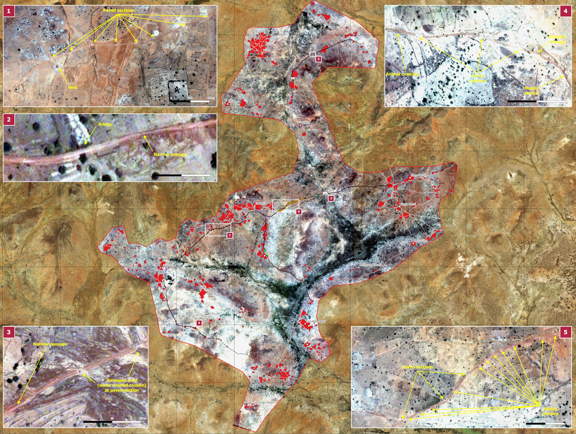
Figure 2 : Example of final product: Road status and vulnerability assessment in Barga, Burkina Faso. Image © CNES (2019), Distribution Airbus DS.
, Distribution Airbus DS. ")
Figure 3: Example of image analysis on 2 small infrastructures. Images © CNES (2016, 2020), Distribution Airbus DS.
Over 70% of the small infrastructures’ projects were validated by the analysis, and more than 80% of the roads of interest confirmed as improved, providing the World Bank team with updated information and demonstrating the value of remote supervision in fragile contexts.