In spring 2020, a World Bank Group team working on an economic assessment of the English-speaking part of Cameroon submitted a request to the EO4SD FCS consortium to help them assess over time the evolutions of structural assets.
They aimed at evaluating the impact of the recent straining of relations between the region and the rest of the country.
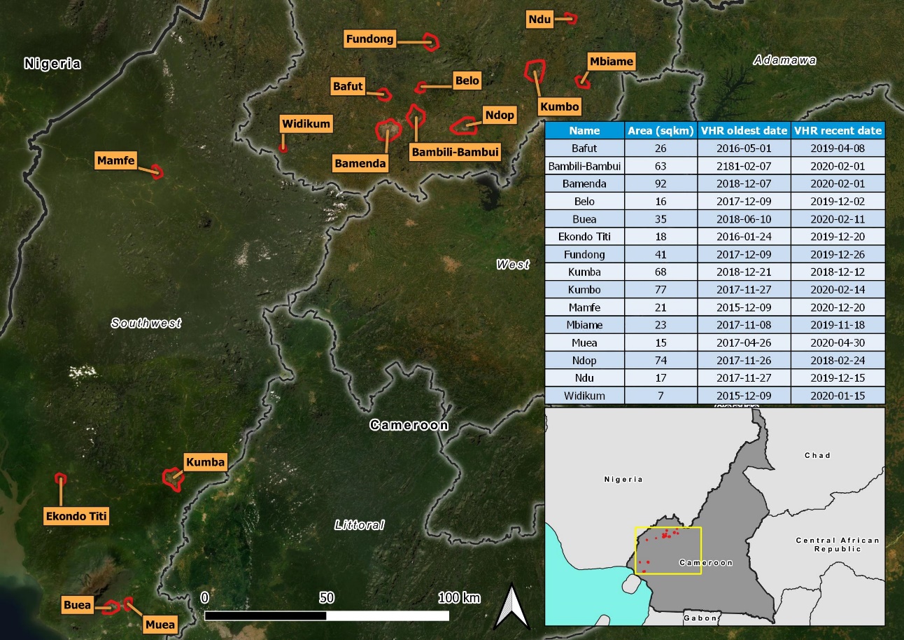
The service demonstration was led by SIRS with the support of GISBOX, with 2 additional AOIs analyzed by UNOSAT to demonstrate feasibility. For each AOI, 2 dates of analysis were chosen to reflect the evolution of building condition before and as close as possible after the known events (2015-2018 for the reference images and 2018-2020 for the post-event images according to VHR archives available over the areas).

Figure 1: Localization of the Areas of Interest
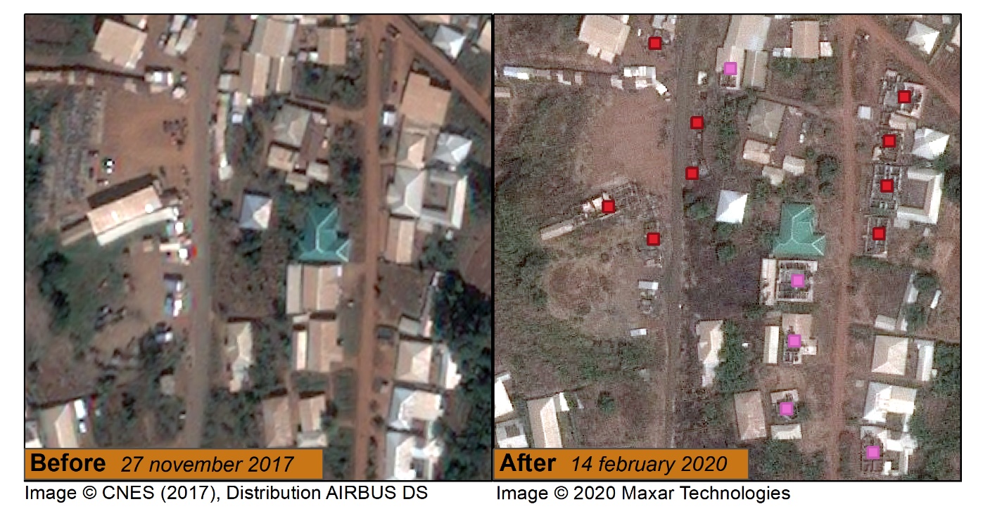
The analysis was conducted by means of visual interpretation of very high resolution optical satellite imagery (pixel size is 0.5m) over 16 Areas of Interest in the Northwest and Southwest English-speaking regions of Cameroon. The results were provided in the form of a geospatial dataset (point features) ready for GIS integration describing the condition of the buildings in the area in case of change detection, ready-to-print maps, and detailed description in the Service Operations Report.

 0
0
Figure 2 : Example of image analysis
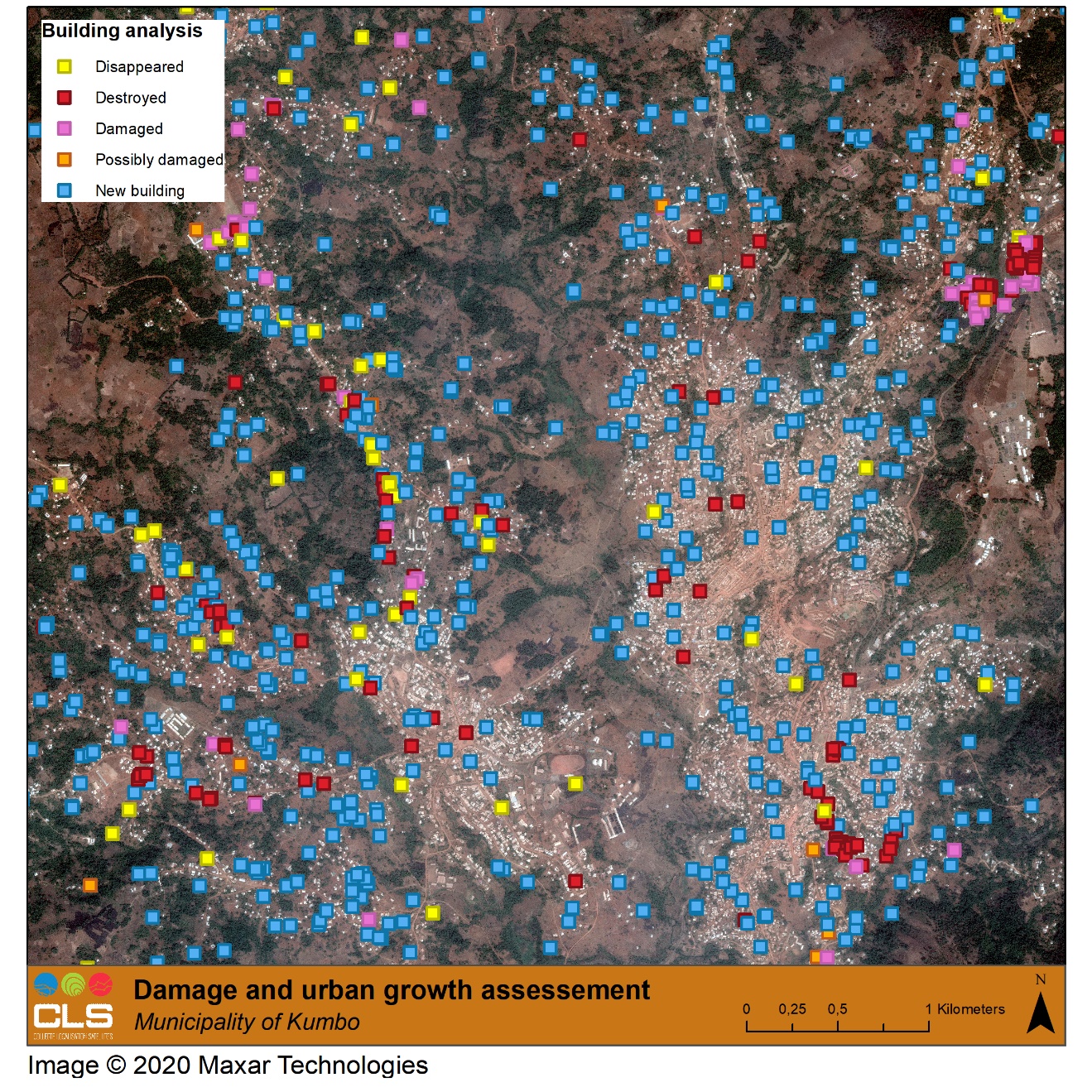
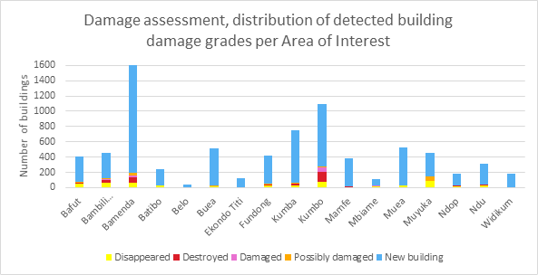
Overall, almost 600 km² were analysed and over 7,000 buildings reported as changed, providing the World Bank team with a wealth of information to support their economic analysis and a report publication. If many of the targeted municipalities exhibited signs of building damages, all areas also showed an unexpected number of new constructions and buildings.

Figure 3 : Results of the building analysis
The resulting geospatial dataset has been published on the World Bank’s Data Catalog and the feedback from the WB team was particularly positive:
“Indeed, a big thank you from our end for all the work that went into compiling the data sets.”

