The two-day workshop will cover a variety of topics related to the use of remotely sensed geospatial information to support the development priorities of the Government of Colombia. These priorities include for instance cadastral mapping, the management of wetlands, urbanization, and migration.
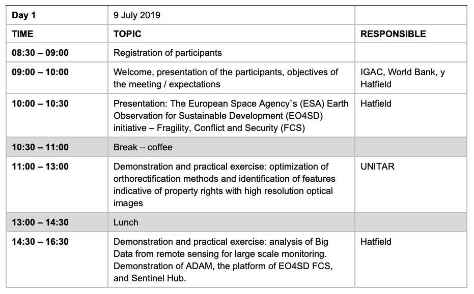
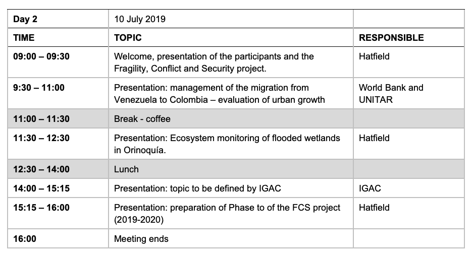
The first day of the workshop offers practical exercises on how to orthorectify optical satellite images and identify features indicative of property rights, and a practical session about the analysis of Big Data and the platforms that exist to process this in the cloud. The second day includes presentations about remote sensing for the evaluation of urban growth and monitoring of tropical savannah wetlands.
The agenda for the meeting is the following:


